Project Details...
This series was commissioned by FotoDocument and Photoworks and opened as part of the Brighton Photo Biennial 2014. Work from the series is being exhibited on Hove Sea Front from October 2014 to July 2015. Exhibition Details here - bit.ly/ZrIrwB --------------------------- Brighton and Hove have been shaped and influenced by water. Not just through an evolving relationship with the sea, but through the challenges of securing a reliable supply of drinking water and dealing with sewage and the spread of disease during the rapid growth of the 19th Century. The challenges continue today, as population growth, increased water consumption and a changing climate all put pressure on water resources. As a result, Brighton & Hove is classified as an area of ‘serious water stress’. As there are no rivers within Brighton & Hove, the city is entirely reliant on the chalk aquifer that sits beneath it and the Downs for its drinking water. This store of fresh water must be carefully managed and protected to provide a clean and reliable supply. As a coastal city, it must defend itself from the sea and be prepared for more frequent extreme weather events and rising sea levels, while maintaining and improving seawater quality and protecting vulnerable marine life and habitats. The recent designation of a Marine Conservation Zone west of Brighton Marina and the award of UNESCO Biosphere Reserve status to the area are positive steps. The One Planet Living principle of sustainable water sets high standards to aspire to. Some standards can be met by education and simple changes in behaviour, while others can only be achieved through new technologies and long-term investment in infrastructure.Building on the work of forward-thinking people in the past and with innovative thinking for the future, the city is striving to create a more sustainable relationship with water, in all its forms. As Brighton and Hove’s seafront is so well known, I have tried to focus my attention away from the more traditional views of the city. With my background in environmental science, I was eager to learn more about the region’s geology and the influence the chalk landscape has had on the city. I also wanted to look into the city’s history and to see what impact past events have had on Brighton and Hove’s relationship with water. My intention has been to form a narrative between history, landscapes, people and infrastructure and highlight some of the ways local residents, businesses and the council are conserving, protecting and recycling water today. Like much of my previous documentary work, I shot the majority of this series on a large format 5x4” sheet film camera. The clunky nature of the camera and expense of the film place limitations on the way I can work. Although this can be frustrating, I find these limitations help me to focus on the people, places and topics that I am most interested in and new opportunities and ideas arise as a result. I have learned a lot about water in Brighton and Hove and the South Downs while working on this series. I have also been reminded about how disconnected many of us are from where our natural resources come from and where our waste ends up. In the case of water, it is important that we constantly remind ourselves what a vital resource it is and that we can’t just take it for granted.
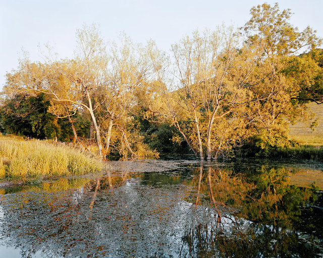
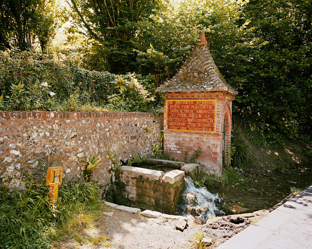
Spring at Poynings.
There are no rivers running through Brighton and Hove. However, you can find fresh water bubbling to the surface along a line of springs just north of the city. This gently flowing river is fed by a spring at the foot of the Devil’s Dyke Combe.
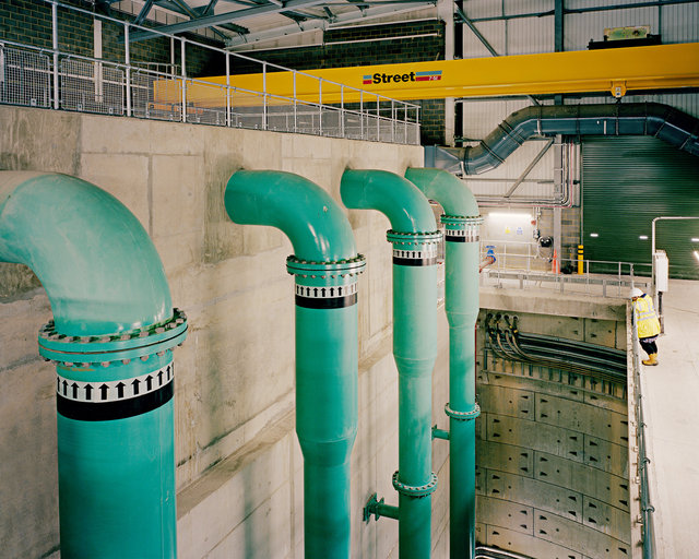
Water Supply Works, East Brighton
Brighton and Hove’s drinking water is sourced entirely from 13 boreholes sunk into the chalk aquifer beneath the city and the Downs. Water stored up in the aquifer during the winter months, is vital for supplying the city during the summer when demand peaks. Southern Water must carefully monitor ground water levels so as not to abstract too much water in any one area and to prevent salt water intrusion into boreholes located closer to the sea.
Water Supply Works, East Brighton
This water supply works and pumping station in East Brighton was built in 1932. It has 3 boreholes that currently supply 12.9m litres per day, just over 10% of Brighton & Hove and the surrounding area’s water. All the boreholes sit within the main chalk aquifer, and water is abstracted through a system of horizontal tunnels or ‘adits’ - many of which were hand dug - that intercept water flowing through the fractured rock.
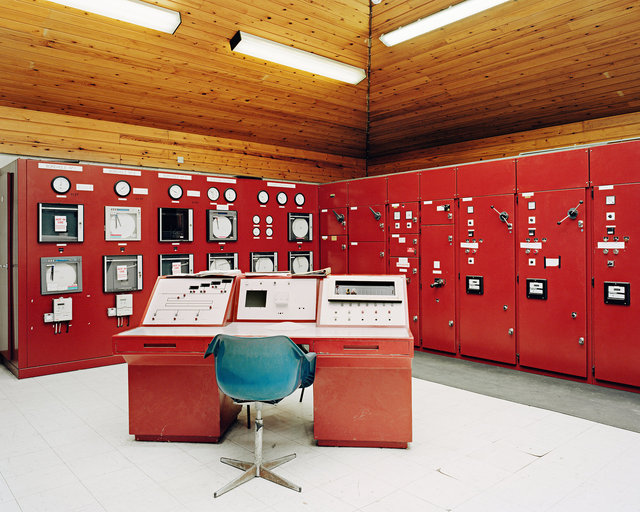
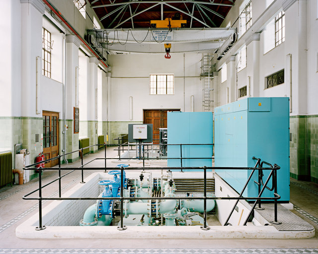
Control Room, Water Supply Works near Lewes.
This water supply works was built in 1955. It supplies approximately 11.5m litres per day. These machines monitor and control the output from the borehole. They are linked to a regional control centre so they can be operated remotely.
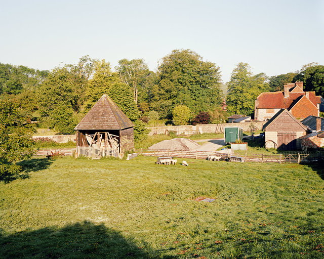
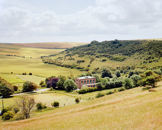
Donkey Wheel Well, Saddlescombe Farm.
Saddlescombe is located on top of the Downs chalk, where the water table lies 45m below ground level. Three separate water systems were installed at the farm during the Victorian era. A donkey wheel well (built in 1855) pumped fresh water from the chalk aquifer; rainwater was collected on most of the farm roof tops and fed into underground storage tanks; and any surface waters running off the farm flowed into a drainage system, through sediment traps and then directed into a leak ditch and spilt across crops in nearby fields. Saddlescombe Farm was bought by Brighton Council in the 1930’s to help protect the Downs and the vital water catchment which supplied the city with its drinking water. The farm was acquired by the National Trust in 1995.
Rainwater Catch, Stanmer Park
John Lawrance of The Stanmer Preservation Society, standing on a rainwater ‘catch’ built for the Earl of Chichester between 1870-1875 to supply drinking water to Stanmer House. When rain fell on the concrete and flint catch, it flowed downhill to a basin at the foot of the hill. The water was then filtered through sand and charcoal and then fed into large storage tanks under the grounds of Stanmer House. Each cottage in Stanmer village also collected rainwater on the roof, which was then filtered and stored for drinking water.
Rainwater Harvesting System, Jubilee Library
Les Pawlack (left) and Bob Fletcher (right) working on the rainwater harvesting system on the roof of The Jubilee library. Rainwater drains through the pebbles, and is then filtered into a grey water system and used to flush the toilets. It reduces the library’s water use by approximately 7% a year.
Spring and Pump House, Fulking
Spring water runs into this stone basin next to a Victorian pump house in the village of Fulking. The water was initially used as a sheep wash by local shepherds, but was later harnessed to provide a piped water supply for the village around 1886. The system supplied Fulking with piped water until mains water arrived in 1951.
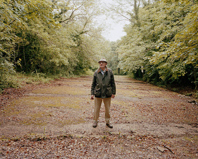
Woodingdean Well, Nuffield Hospital
The World’s deepest hand-dug well sits next to the entrance to the Nuffield Hospital in Woodingdean. Work began in 1858, with men digging 24 hours a day by candle light in appalling conditions. It was not until the 16th March 1862 that water was finally reached. At 1285 feet deep (850 of which are below sea level) this brick-lined well is deeper than The Empire State building is tall.
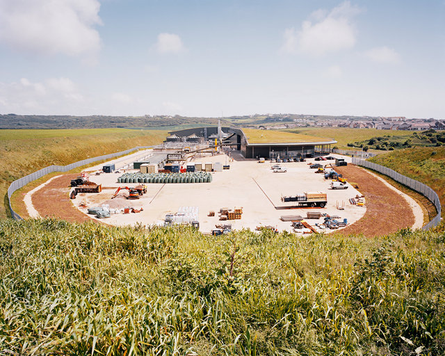
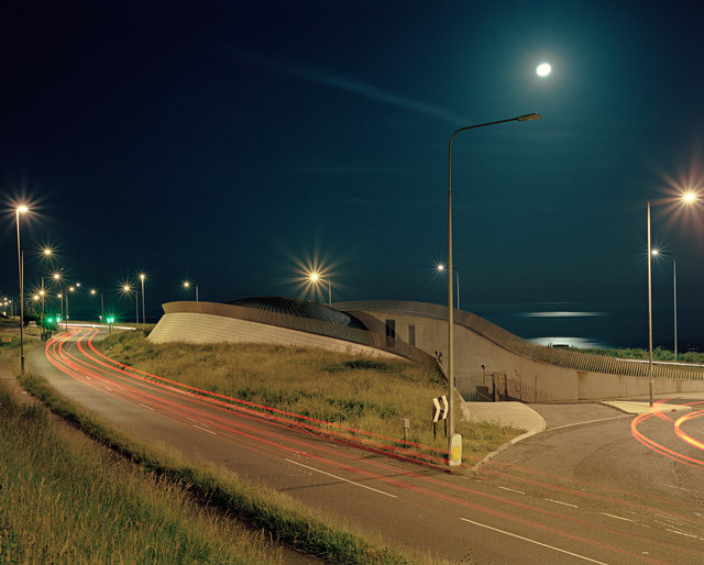
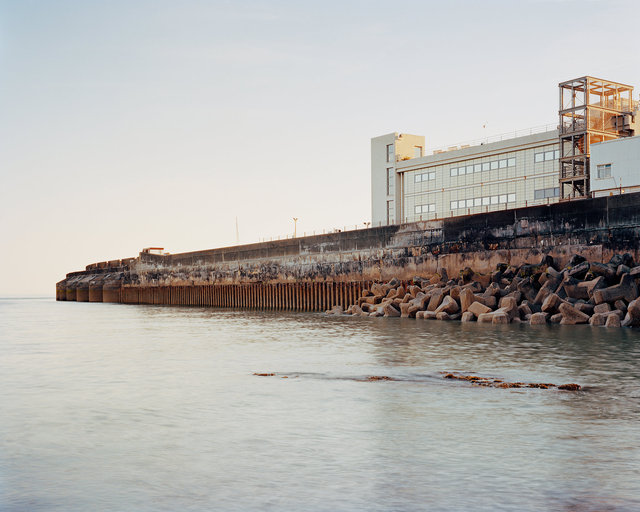
Peacehaven Wastewater Treatment Works
This treatment works opened in early 2013 as part of a £300m improvement programme by Southern Water to meet EU wastewater regulations. The plant treats over 95m litres of wastewater produced each day by Peacehaven, Telscombe Cliffs, Saltdean, Rottingdean, Ovingdean and Brighton & Hove. The treated water is pumped out to sea via a new 2.5km sea outfall.
Living Roof, Peacehaven Wastewater Treatment Works
A railing marks the edge of an 18,000 m2 living roof that covers much of the treatment works and helps to blend the buildings into the landscape. It covers an area the size of three football pitches, and is one of the largest in Europe.
Inlet Pumping Station, Peacehaven Wastewater Treatment Works
When wastewater arrives here at the treatment works, it is pumped 22 metres upwards to allow it to flow around the facility by gravity.
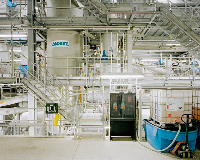
The Drier, Peacehaven Wastewater Treatment Works
Wastewater sludge is heated to over 400°C to remove 95% of remaining water. The solid granules that are produced from the drier are used in agriculture as a soil conditioner. Gases produced during the treatment process are used to generate power for the facility.
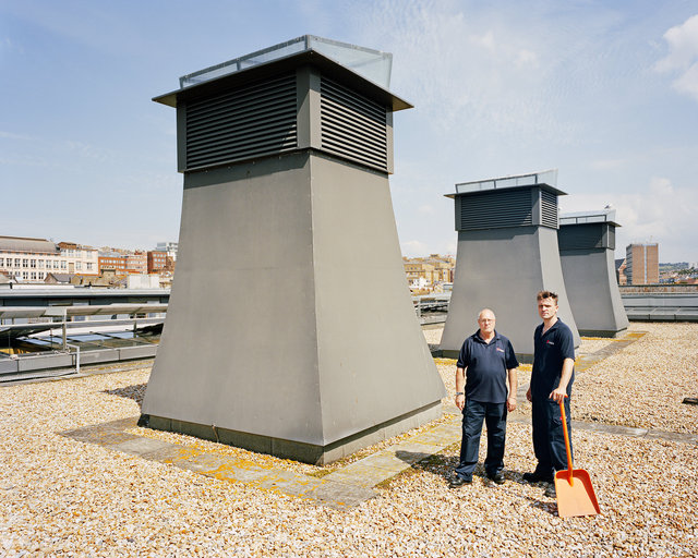
Marine Drive Pumping Station, Roedean
This new pumping station was built as part of a £300m improvement programme by Southern Water to meet EU wastewater regulations.
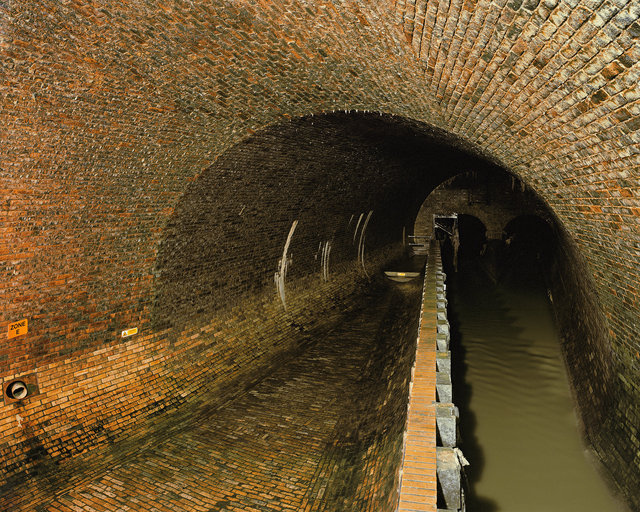
Victorian Sewers, Brighton.
Built between 1871 and 1874, these sewers were designed to cope with the rapid population growth of Brighton & Hove and to direct sewage away from the city’s beaches and bathing areas. The sewers are still in use and have an estimated lifespan of 500 years. Sewer tours have been running since 1956 and continue today. They help educate visitors about where their sewage ends up and about what not to put down their toilets and drains.
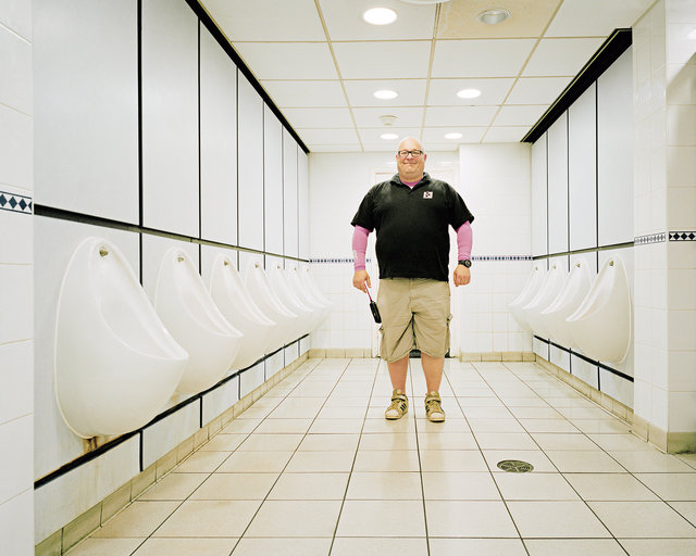
Ian Hardy, Buildings Manager at The Brighton Centre
“We had 96 urinals flushing every 20 minutes in this building. That’s an awful lot of water! We’ve cut that down by over two thirds.” By installing a more efficient flushing system for the venue’s urinals, the Brighton Centre is saving an estimated 13,000 litres of water a day.
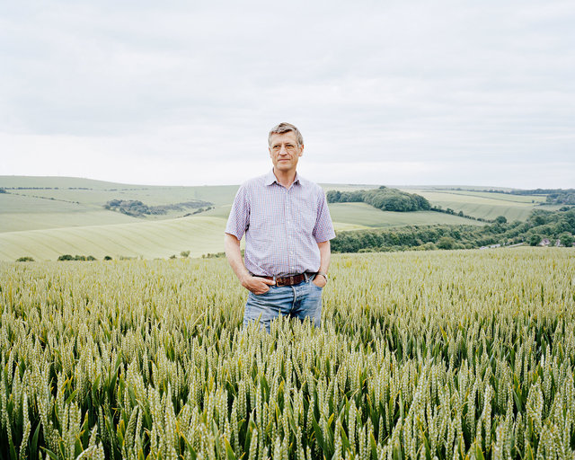
David Taylor, Housedean Farm
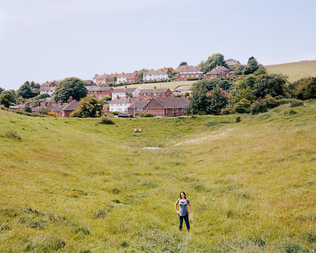
“The soil on the Downs is inherently poor and drought prone. Because of its low fertility, it requires quite a lot of fertiliser to produce an economic crop.” In an attempt to limit the amount of fertiliser entering the groundwater, David was asked to take part in a soil mapping initiative funded by the Environment Agency. Soil samples were taken from every hectare of his farm. The results were used to create a detailed fertility map, showing the levels of nutrients across the land. The data was then combined with GPS co-ordinates, so fertiliser can be automatically applied by the tractor at the correct levels, depending on where the soil is nutrient rich or poor. David rents 900 acres of farm land from Brighton & Hove City Council. Brighton Council began buying up land around the city in the 1890’s to protect the Downs from over development, and to preserve the valuable water catchment. The Council now owns 11,000 acres of farm land.
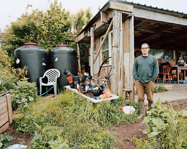
John Fryer, Whitehawk Community Food Project
“We collect rainwater, partly to be free from dependency on mains water, but primarily it’s to do with the fact that plants prefer rainwater to tap water. When we water plants with rainwater they respond much more vigorously and happily, than they do with tap water.” Founded in 1996, the Whitehawk Community Food Project is based on a 1 acre allotment on Whitehawk Hill, East Brighton. They harvest rainwater on all their roofs and store it in large tanks at the top of the allotment. This then flows downhill to water butts throughout the site from which they water the plants by hand with watering cans and buckets.
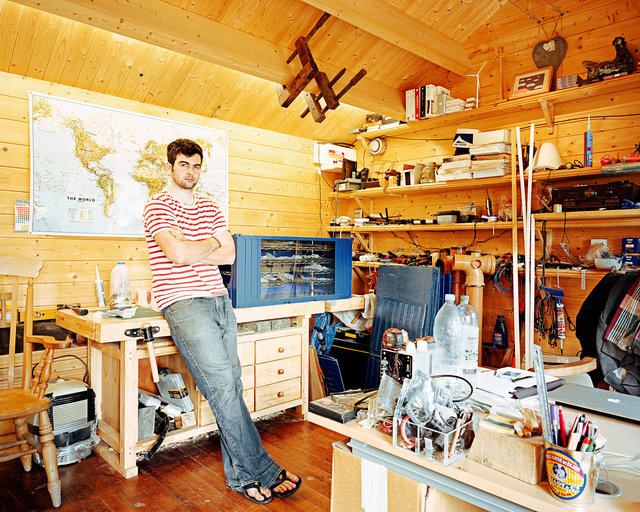
Chris Toureau, Design Technology & Irrigation (DTI-r)
DTI-r is an intellectual development company based in Poynings. The company has developed an innovative new use for a membrane material made by DuPont. When irrigation pipes are lined with the membrane they can be filled with almost any type of unpurified water - saline, polluted, or wastewater. The membrane allows water vapor - which cannot carry salts - to diffuse through the pipe walls, while the contaminants are retained within the pipes. This process is known as pervaporation. Chris has spent four months working at NASA testing the membrane to see if it could be used in the future for water recycling on the International Space Station. The membrane has many other possible applications such as the development of agriculture on previously non-arable land and in disaster relief situations.
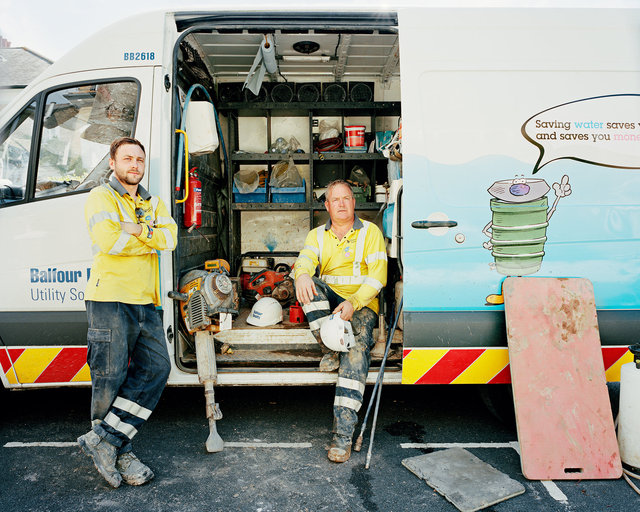
Liam Goodwin (L) and Kevin MacFarlane (R), Meter Installation Team.
Southern Water is installing over 75,000 water meters in Brighton & Hove as part of a multimillion pound initiative to get their customers to use less water. The average household uses about 10% less water once a meter is installed. Widespread installation of water meters also helps Southern to identify leaks across the system and to reduce water loss.
Cascade Dam, Bevendean.
During periods of high rainfall, Brighton & Hove can suffer from significant surface water flooding. Maggie Moran, a flood engineer for the City Council, is standing at the base of one of three large cascade dams and soakaways built in the early 1950’s and updated in 2001, to mitigate flooding of residential streets in Bevendean. Similar flood mitigation measures have been constructed in other risk areas, predominantly where the city meets the South Downs.
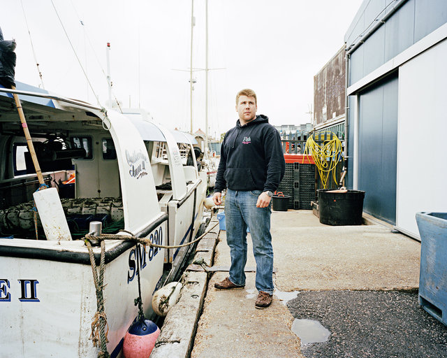
Charlie Brock, Brighton & Newhaven Fish Sales
“We like to focus on bringing to the forefront of people's minds how many different species there are in the sea. We tend to focus on salmon, tuna, cod and haddock as a staple diet in the UK, and don’t look at the lesser species, that we all know in the industry are brilliant to eat; Gurnards, Pout Whitings, Pollocks, Wrasse. It's about diversifying what you eat and about education as well. We are trying to promote local fish and the local fleet.”
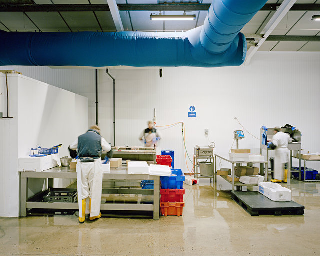
Staff Sorting Fish at Brighton & Newhaven Fish Sales
BNFS is based at the eastern end of Shoreham Harbour. They sell high quality local fish, caught each day by three of their own boats, and by a fleet of other local owner-operator vessels. They sell directly to local wholesale customers and to the public through their shop located on the quayside. They are the only UK fish market that owns fish quotas so they give a guarantee of provenance and ensure that all the fish they sell has been caught sustainably and is 100% legal.
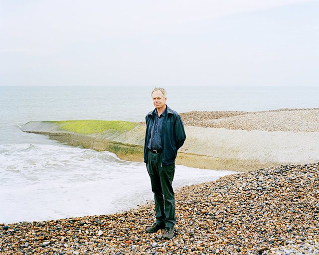
Martin Eade, Coast Protection Engineer, Brighton & Hove City Council.
Martin Eade and a team of engineers have recently completed a study on coastal erosion and risk management for the coastline between Brighton Marina and the River Adur for the next 100 years. With the climate changing, sea levels rising and increased frequency and intensity of storms, the existing coastal defences are under increasing threat. As a result of the study, a programme of future improvements works will be implemented to make the coast defences capable of withstanding a 1 in 200 year storm event.
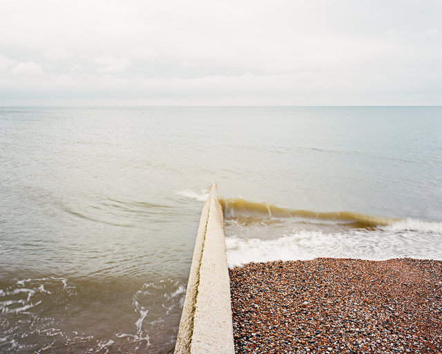
Groyne and Shingle Beach, Hove
The coast between the river Adur in the west and Brighton Marina in the east, is called a ‘closed cell’. Any shingle arriving at the western end is brought by the process of ‘longshore drift’ along to the eastern end. This means that the beaches in the east get bigger, and the ones in the west gradually get smaller. To manage this, shingle must be periodically replaced at the western end. The role of groynes is to stop shingle moving along at the speed it wants to move, and to accumulate it between groynes, as beaches. By absorbing large amounts of wave energy like a sponge, the shingle beaches are a vital part of coastal defence.
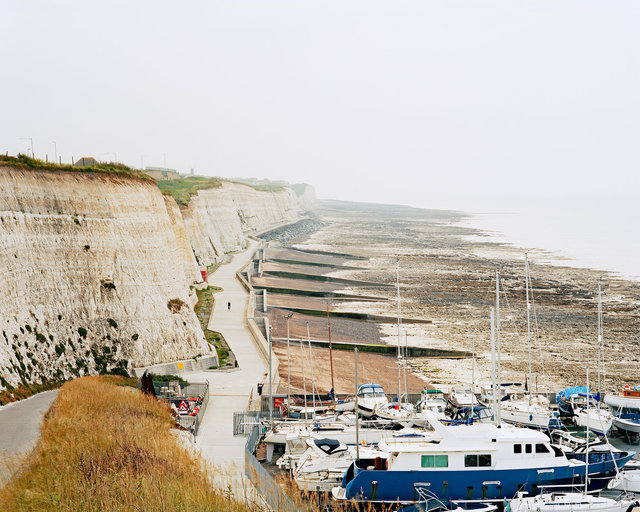
Undercliff Walk, East Brighton
The Undercliff Walk and sea wall were built between 1928 and 1935 and run from Black Rock to Saltdean. The wall protects the foot of the cliffs from erosion and groynes help maintain the shingle beaches. These defences have been gradually renewed and improved over the last 15-20 years. Through researching the formations contained within the cliffs, geologists are able to reconstruct and further understand climate change and sea level rise in the past. The cliffs are protected by a number of designations including Site of Special Scientific Interest (SSSI).
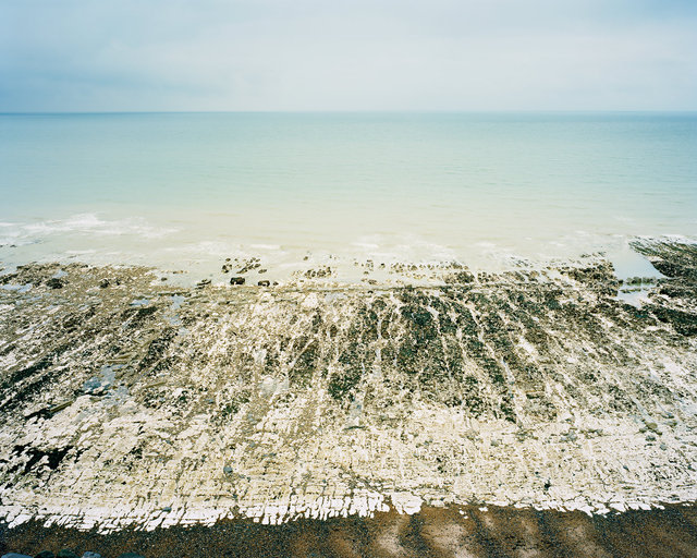
Chalk Wave-Cut Platform, East Brighton
A chalk wave-cut platform runs east from Brighton Marina to Newhaven. The platform is designated as a Site of Special Scientific Interest, is protected by the Beachy Head West Marine Conservation Zone and is within the recently awarded UNESCO Biosphere Reserve.
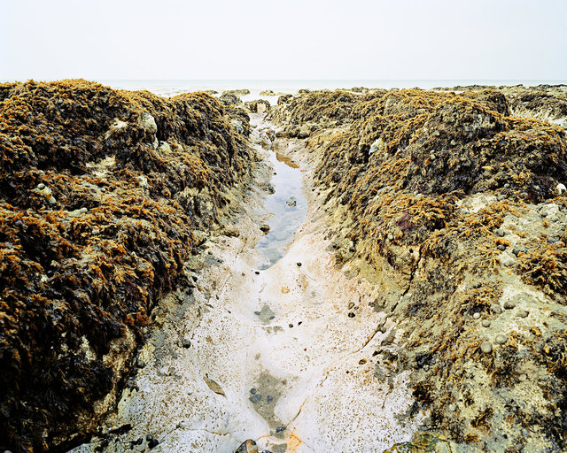
Chalk Wave-Cut Platform, Ovingdean.
The distinctive parallel gullies, ridges and rocky tide pools of the wave-cut platform support a wide variety of important species such as sea anemones, blue mussel and native oyster beds. Long and short-snouted seahorses, which are protected by law, can be found in the shallower waters and the subtidal chalk reef.
Western Breakwater, Brighton Marina
Brighton Marina is well protected from the English Channel by two long breakwaters. Behind these walls and beneath the boats, the sheltered marina provides a lagoon environment that supports a diversity of species more typical of deeper water habitats, including several sponge species and short-snouted seahorses.